Repurpose the rail corridor
Exercise while commuting: Facilitating an active lifestyle along the rail corridor
SITE
|
|
The Rail Corridor is a 24 km is a remnant of a now defunct railway line that stretches from the north of Singapore at Woodlands Immigration Checkpoint to the south at Tanjong Pagar Railway Station. Development over the last decades occurred around the railway line, preserving an interrupted land parcel which ran through the heart of Singapore. This project examines the feasible of active commute along the rail corridor via cycling/running and explores the possible design interventions that supports routine centred on the rail corridor.
|
SYSTEM
ANALYSIS
|
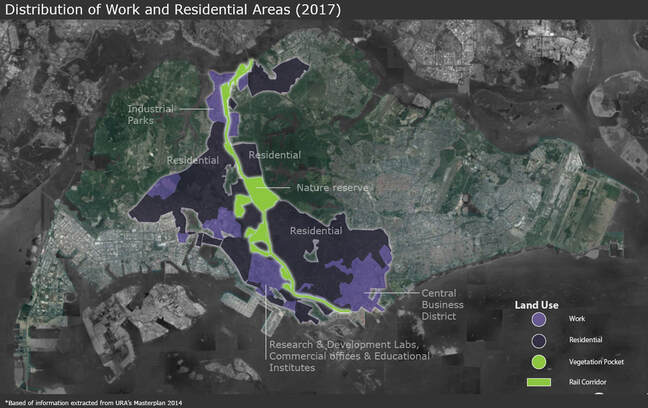
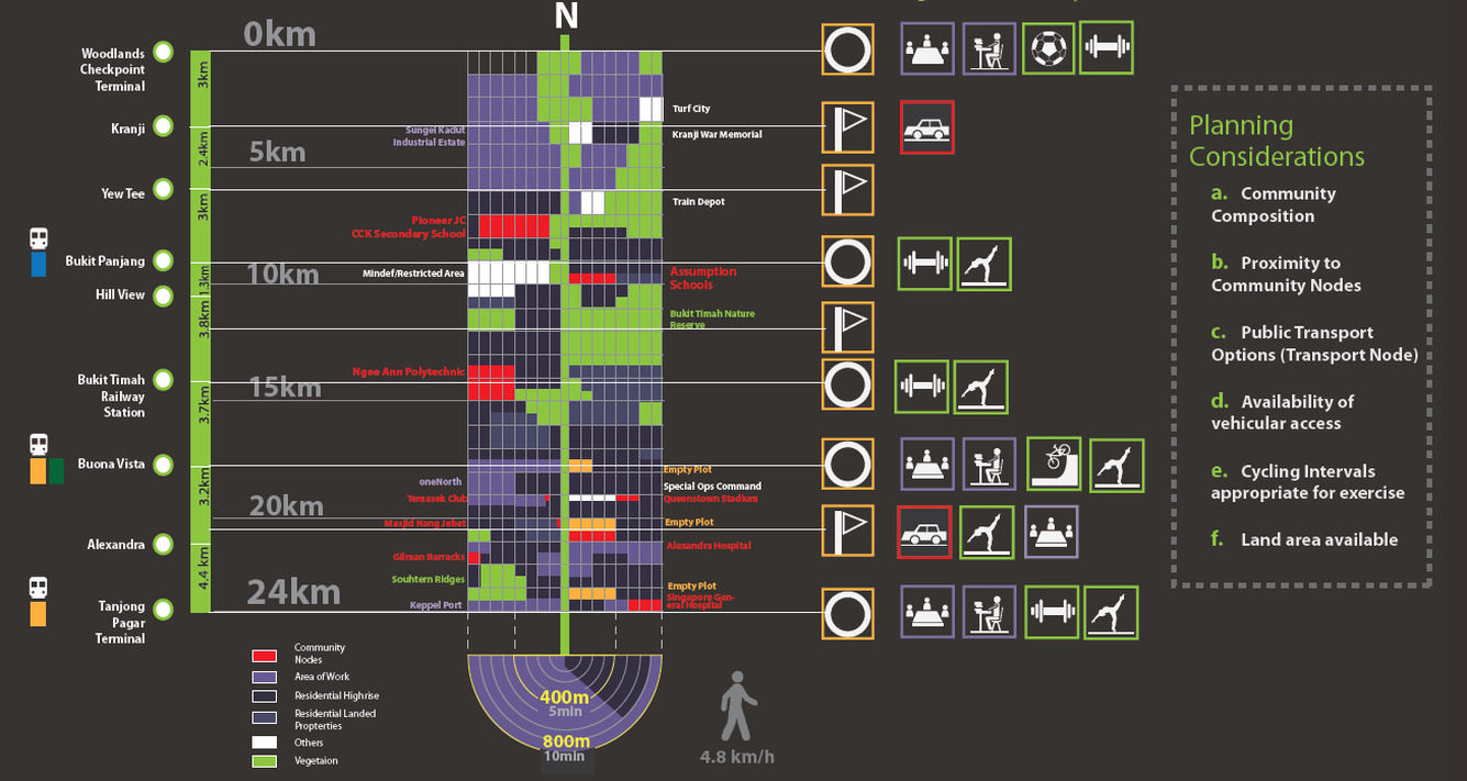
The Rail Corridor lies in close vicinity to 3 major Work clusters. To the north, there is a Work cluster that consist primarily of industrial parks. To the south, the Rail Corridor spans across an R&D Work cluster and Commercial Work cluster at the CBD area. It cuts through dense urban landscapes that includes both residential and commercial areas, providing a direct connection between diverse neighborhoods and serves as a wildlife corridor between the pockets of green and wildlife reserves.
|
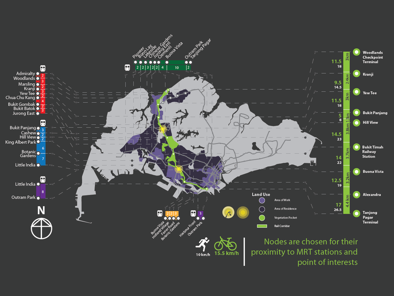
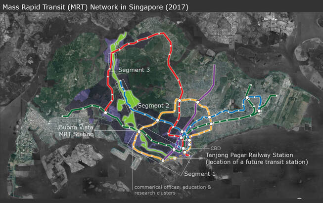
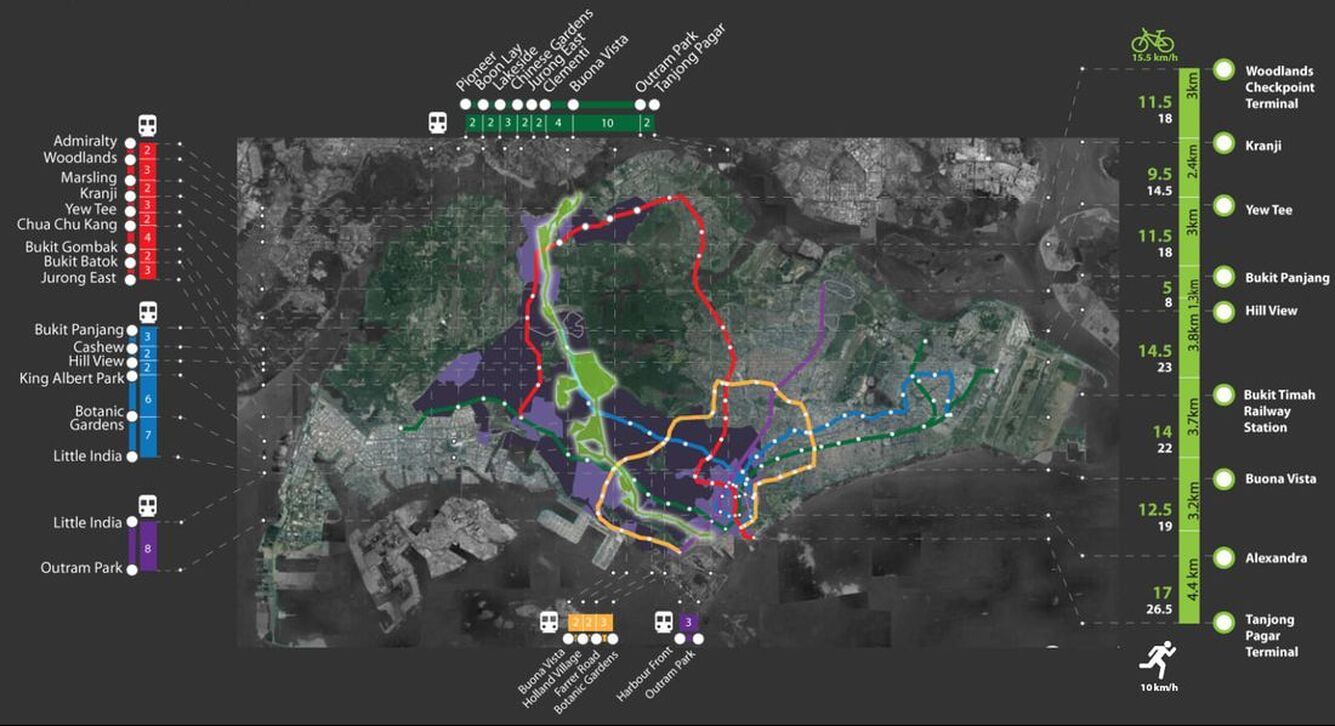
Singapore is home to an efficient rail network in, making it an integral part of commute for much of the population. There are 3 segments of the Rail Corridor that runs in parallel to the transit service lines, which can offer alternatives for commuters travelling along the same direction.
|
Travel time is a key factor that commuters considers when making decisions on potential travel routes. The time taken between the stations and the time taken to cycle between the key nodes are mapped in the above diagram. Segments of the rail corridor that bridges key commuter nodes are identified and analysed further to identify locations for intervention.
DESIGN INTERVENTION
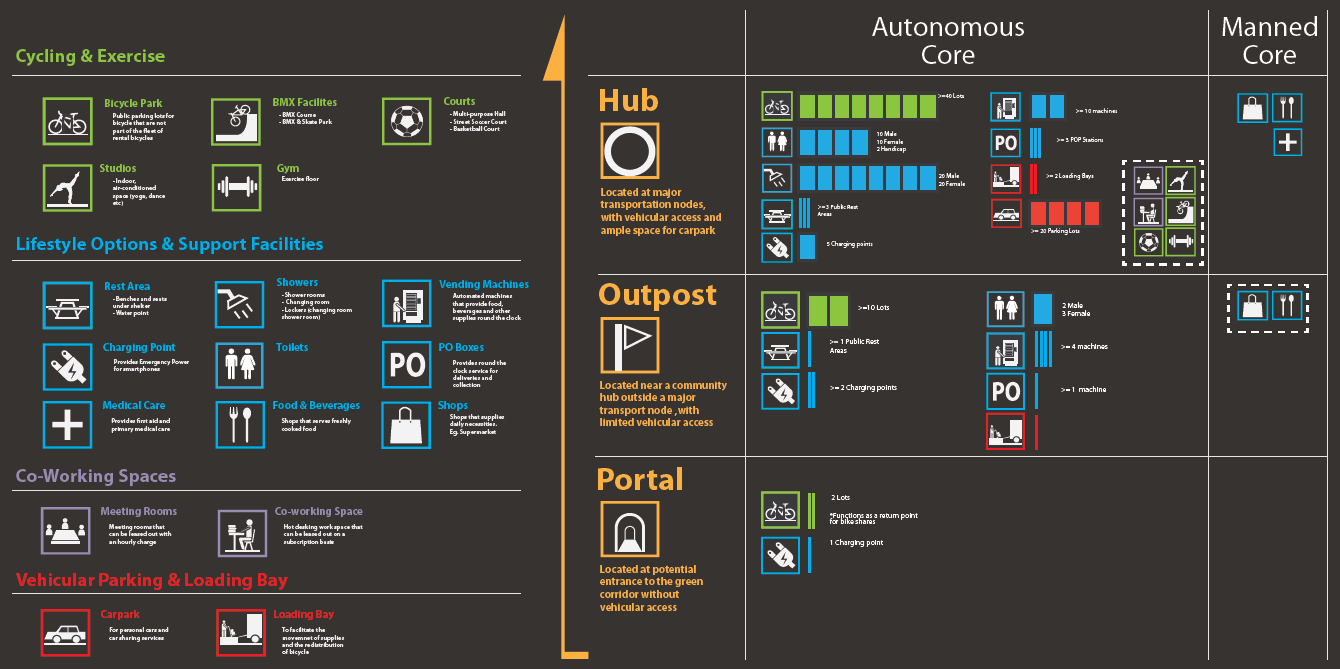
The Rail Corridor consists of land parcels that are of vastly different scales with a variety of programmatic requirements that are location specific. The design needs to provide the flexibility to adapt to various site conditions while maintaining a coherent visual language along the corridor. This aids with wayfinding and helps establish the corridor’s presence within the public conscious.
Three typologies are proposed to address the requirements across different scales. Each typology utilizes a green trim and mesh as the main motif. They can be permutated and adapted according to site conditions.
Three typologies are proposed to address the requirements across different scales. Each typology utilizes a green trim and mesh as the main motif. They can be permutated and adapted according to site conditions.
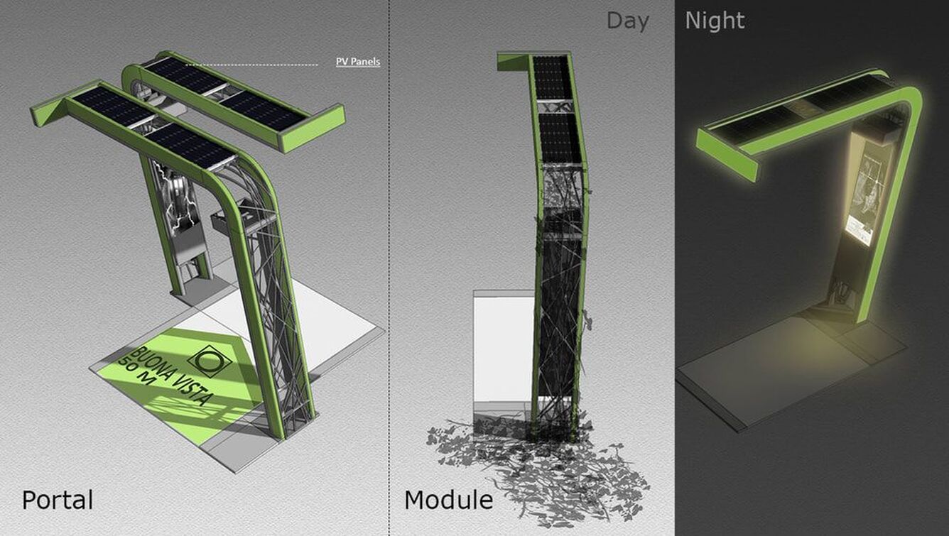
TYPOLOGY 1: PORTAL
Portal is the smallest of the 3 typology, with the primary function of marking the entrances into the Rail Corridor. A single module is intended to function as waypoints for navigation and to provide soft lighting in areas that are close to nature preserves.
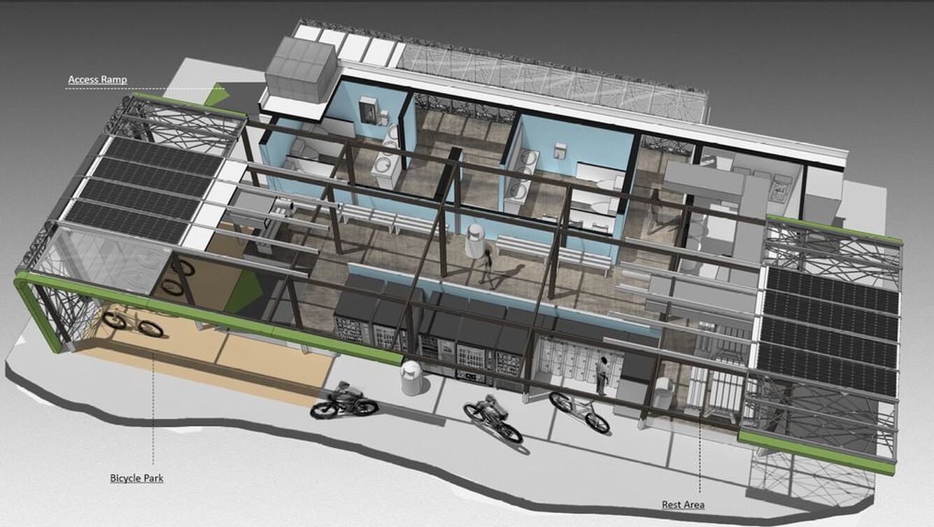
TYPOLOGY 2 - OUTPOST
Outposts are intended to function as pit stops along the Rail Corridor. As such they house toilets, rest areas and vending machines. They provide immediate shelter and simple supplies for commuters travelling along the Rail Corridor.
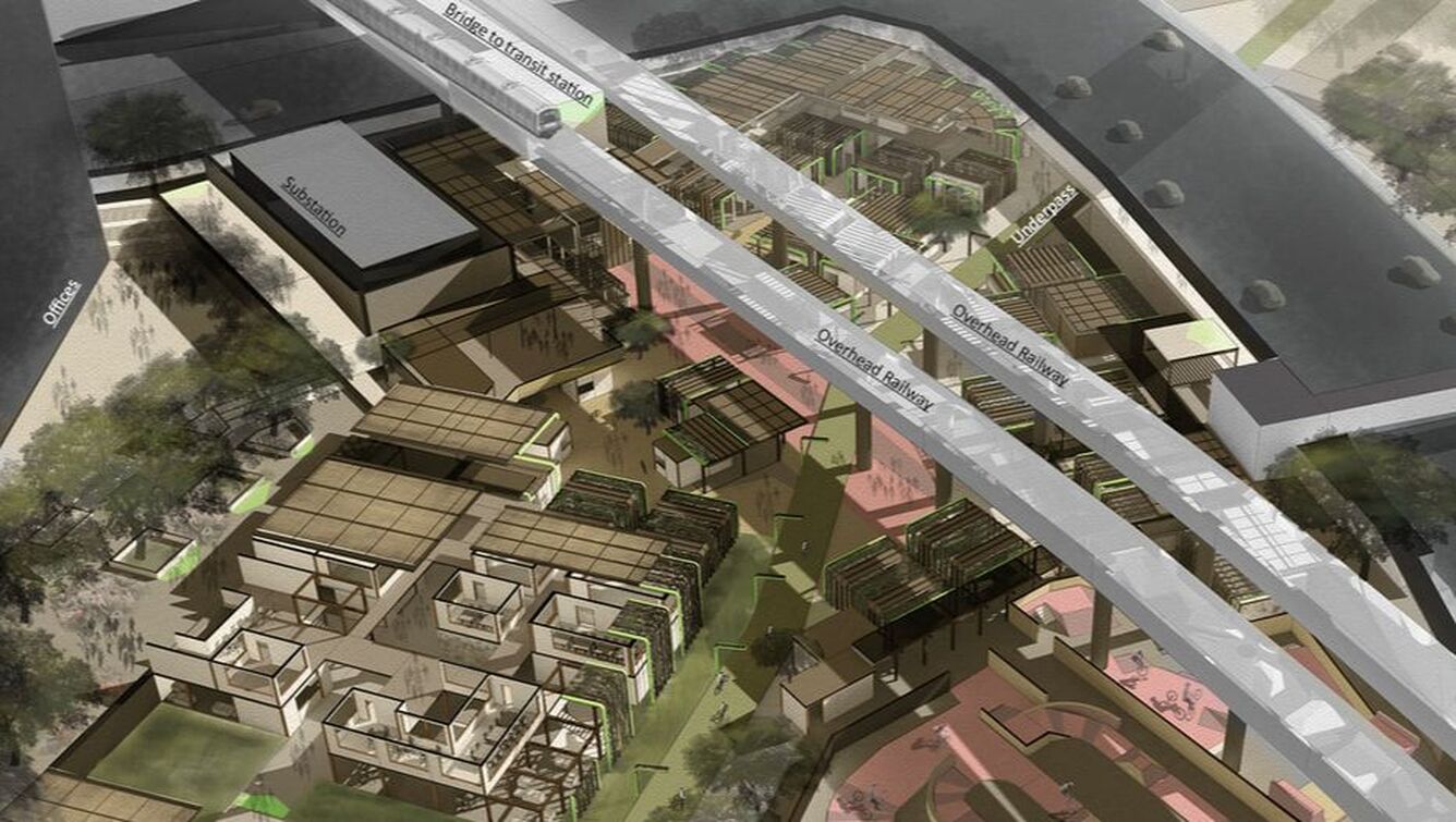
TYPOLOGY 3 - HUB
Hubs are designed to house provide all the facilities and services that a typical commuter would expect. They are also intended to serve as crowd catchment areas during peak hours and thereby reducing the load on the public transport network. At Buona Vista, the availability of a large undeveloped plot allows for the creation of streetscapes and community clusters. The buildings are arranged in a street like configuration and scaled to provide pedestrian and bicycles barrier free access to all services. Individual buildings are kept low such that they are shorter the surrounding trees, which helps to preserve the Rail Corridor’s tropical characteristics and atmosphere.

